
Specs
ZoneWatch, by the numbers.
Coverage, cadence, resolution and lead times for ThreatNet, the ZoneWatch Risk Models and ZWCAST.
~2 min
Storm tracking refresh
60 min
Storm forecast positions
0–18 h
Lightning & wind risk
3 km
Forecast grid
10 days
ZWCAST range
ThreatNet Storm
Built by ZoneWatchZoneWatch Storm Track Intelligence
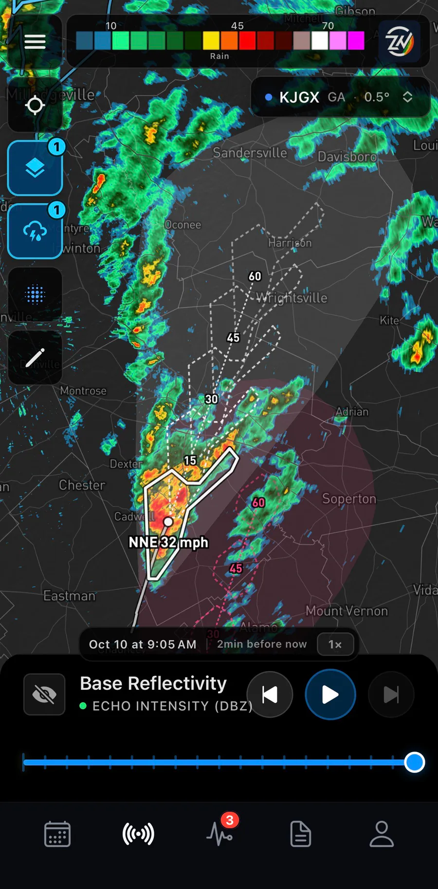
Finds and follows storms across the US automatically, and shows where each one is headed next.
- Coverage
- Nationwide across the contiguous US, plus per-site tracking on individual radars
- Refresh
- Storms re-detected and re-tracked about every 2 minutes nationwide; new radar data picked up within seconds of becoming available
- Per-site tracking
- Updates with each radar volume scan
- Tracking grid
- High resolution, about 1 km
- Per storm
- Outline, motion (speed and direction) and trend: strengthening, steady or weakening
- Track history
- A trail of where each storm has been
- Forecast positions
- 15, 30, 45 and 60 minutes ahead
- Path ahead
- An impact corridor that widens with lead time
- Persistence
- Each storm keeps its identity scan to scan; a storm briefly missing from one scan is held, not dropped
- Freshness
- Flagged out of date after 12 minutes nationwide or 22 minutes on a single radar site, so old tracks never pass for live ones
Advanced radar, included with Storm
Included
- NEXRAD moments
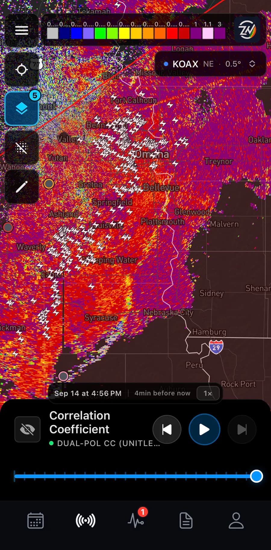
- Reflectivity, velocity, spectrum width, differential reflectivity and correlation coefficient, at any site and tilt, with smoothing on or off
- Storm-scale products
- Storm total, 1-hour and 3-hour precipitation, vertically integrated liquid, enhanced echo tops and hydrometeor classification
- Rotation tracks
- Included
ZoneWatch Risk Models
Built by ZoneWatchLightning Risk and Damaging Wind Risk
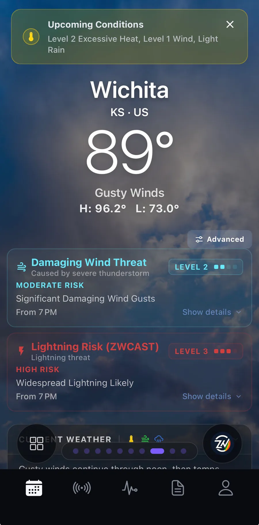
Two forecast models built by ZoneWatch, on the map and on every location you track.
- Levels
- No Threat, Elevated, Moderate, High, Extreme
- Forecast
- Hourly, 0 to 18 hours ahead
- Grid
- 3 km over the contiguous US
- Where they show
- On the map, and as per-location risk cards and alerts
- Damaging Wind impacts
- Each level comes with expected impacts, such as tree and power-line damage, structural damage and risk to high-profile vehicles
- Data integrity
- Missing input data shows as “data unavailable”, never as “no threat”
ZWCAST
Built by ZoneWatchZoneWatch’s forecast engine
Blends live radar observations with high-resolution forecast guidance.
Rapid Update
0–18 h
15-minute steps for the first 9 hours, then hourly
Medium Range
To 10 days
Hourly to about 3 days, then 3- and 6-hourly
- Grid
- 3 km over the contiguous US
- Precipitation
- Expected amounts, with lower chances clearly marked, plus type and timing
- Flooding
- ZoneWatch Flood Notices and Excessive Rainfall Risk levels
- Advanced charts
- Wind, cloud cover and temperature
On the map
Radar and model products
- MRMS
- MRMS high-resolution merged reflectivity and precipitation-type reflectivity
- NEXRAD
- Single-site Level II and Level III products
- Forecast models
- HRRR, RRFS, RAP, NAM 3KM, NAM, GFS, ECMWF, ECMWF AIFS and NBM (National Blend of Models)
- NBM fields
- Temperature, dewpoint, humidity, precipitation, gusts, cloud base and CAPE
- Future Radar
- Out to 15 days with ECMWF AIFS
- Satellite
- Visible, infrared and water vapor
- Lightning
- Real time, the last 24 hours, and totals
Platforms and plans
Where it runs, and how to get it
- Platforms
- ZoneWatch Radar on the web · iOS · Android
- ThreatNet
- Live now on ZoneWatch Radar on the web. Coming to mobile this week.
- Coming next
- ThreatNet Snow: stay tuned.

ThreatNet Storm
$59.99/yr on its own, or included with ZoneWatch Max ($14.99/mo or $149.99/yr).
ZoneWatch works alongside official National Weather Service watches and warnings and never replaces them. Specs describe what ZoneWatch delivers today and may change as the product improves.